Telescoped Hydrologic Model around Seaboard Atlantic Ditch in Babcock-Webb Wildlife Management Area
|
Client: Florida Wildlife Conservation Commission Babcock-Webb Wildlife Management Area
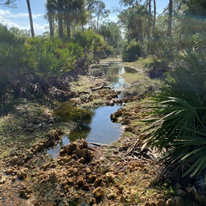
Year: 2021-2022 About: The Seaboard Atlantic (SAL) Grade ditch is located in the north portion of Babcock Webb Wildlife Management Area (WMA) and drains north toward Bermont Road (County Route 74) for eventual discharge to the Peace River. The SAL ditch erosion over the years has resulted in lower water table levels in natural lands in the northern part of Babcock Webb WMA. The main objective of this project is to build a telescoped higher-resolution model of the area contributing to SAL ditch to represent existing conditions. The telescoped model is used later to evaluate scenarios and alternatives for stabilization of the SAL ditch, reducing over-drainage, and increasing water table elevations in the affected areas. |
Specifics:
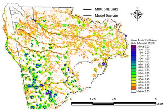
A telescoped MIKE SHE/MIKE 11 model around the SAL Grade ditch was cut from the parent model developed recently by the Coastal & Heartland National Estuary Partnership (CHNEP). The telescoped model with higher spatial resolution included a more detailed conceptualization of the surface water features and utilized boundary conditions extracted from parent model results. Model results are compared with observation station data to assess the model performance. Model performance of the parent model is maintained overall after using a higher spatial resolution and a more detailed conceptualization.
|
Applied Skills:
Consulting Areas:
Software Applied:
|
Telescoped model results showed shorter hydroperiods and smaller wet season water depths around the northern end of the SAL ditch, which is consistent with the field observations. The predicted dry season water table around the northern end of SAL ditch was 10 ft below the ground, which is consistent with the ditch bottom and with the drier conditions in that area.


