Fill Sinks PlusPurpose
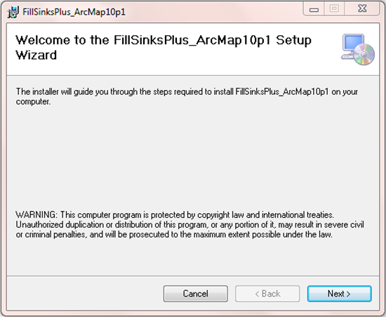
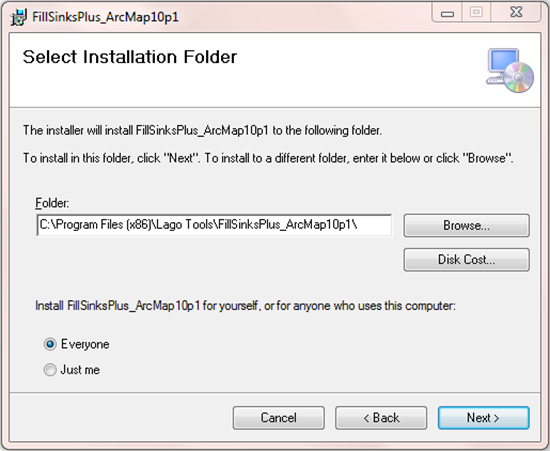
FS+ is a better alternative to the Fill Sinks (FS) operation in ArcMap/ArcHydro for flat topographies with the presence of wetlands and flood plains. Both operations produce similar stream paths in steep terrains, but the FS+ tool generates more realistic flow paths in flat regions. A comparison of both methods is provided in the last section of this document. In addition, the tool can perform DEM conditioning operations to account for sinks and culverts. Usage FS+ is implemented as a Customized Command or button in ArcMap 10 by using the ArcObjects.NET as distributed by ESRI. The installation of this button is detailed in one of the following sections. In order to obtain the modified or “filled” raster, select the DEM raster layer and click on the FS+ button. Currently, this tool is limited to layers originated from raster files, e.g., TIFF files. Thus, for other types of raster layers, the user needs to export the data as a raster file before executing the FS+ tool. FS+ replaces only the FS operation in ArcHydro. Other operations preceding and succeeding the FS operation in ArcHydro must be executed as usual. FS+ considers No Data values in the DEM as sinks. Pre-requisites This tool will run in ArcGIS 10.0 - 10.7 for Desktop Basic (ArcView). The extension Spatial Analyst is not required for FS+. Installation The following steps are necessary during the installation of FS+ for ArcMap 10.1 in a Windows 7 computer.

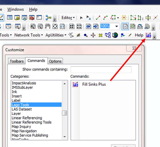
In some cases, “Lago Tool” could not be found in the list of categories as shown above. As a work around this, the user can browse for the file FillSinksPlus_ArcMap10p#.dll inside the program files directory and right-click to register it manually.
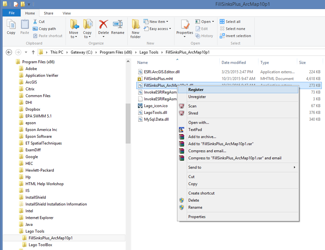
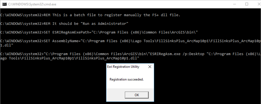
Then, you need to authorize ESRIRegAsm.exe to run in your computer, and click on register in the windows below.
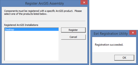
In the case that the option for “Register” is not shown, the manual registration can be done via command prompt as detailed at the ESRI webpage:
http://desktop.arcgis.com/en/arcobjects/latest/net/webframe.htm#AboutESRIRegAsmUtility.htm In order to facilitate this process, a batch file titled “Register_ESRIRegAsm.exe_ArcMap10p#.bat” is also provided in the program file directory. Just right-click the batch file and “Run as administrator”. The print screens below illustrate the process. 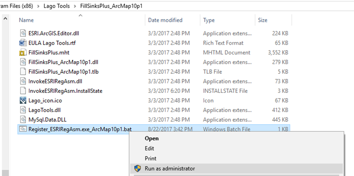
Example of use
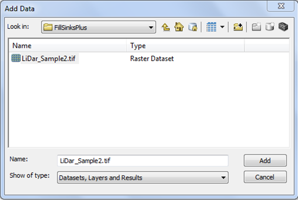
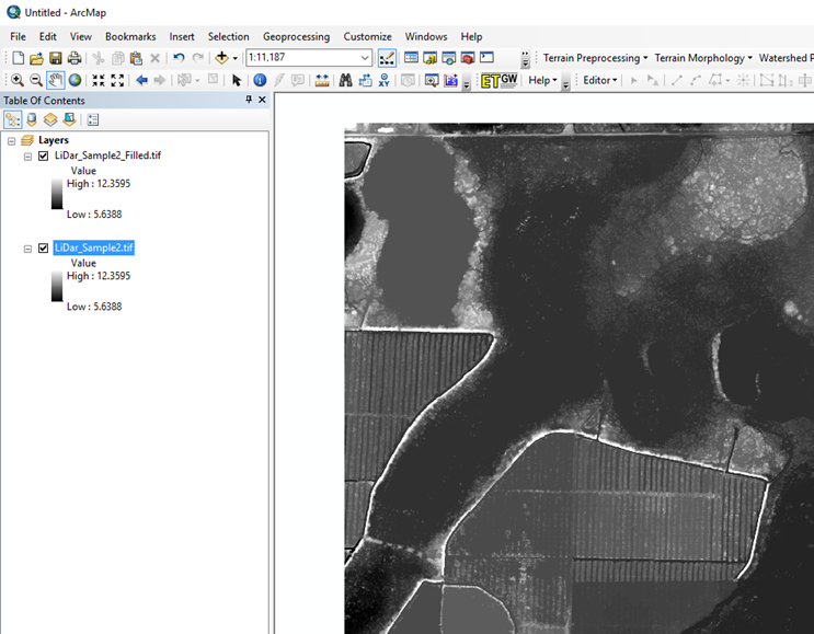
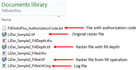
The following steps illustrate the use of FS+ by using the file LiDar_Sample2.tif, which is included into the My Documents folder (e.g., C:\Users\LC\Documents\FillSinksPlus) during the installation process.
The basic fill sink operation can be repeated using the following optional features
Registration
Users can try FS+ for free; however, when using the free version, the message below will be displayed. 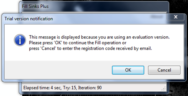
When evaluating the tool, you can clip your raster to less than 800 pixels in each direction in order to have only one of those “Trial version notification” messages.
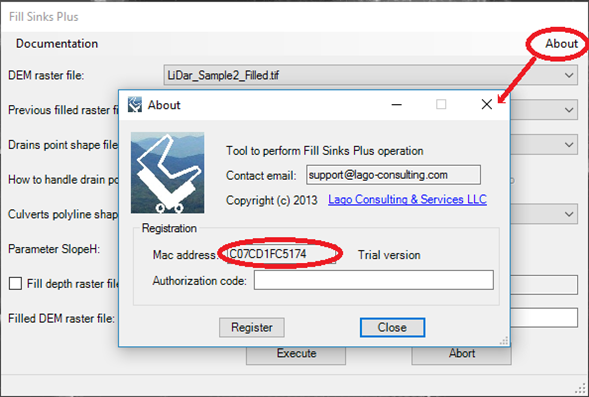
In order to have full functionality of this tool, the user needs to complete the registration by following these steps:
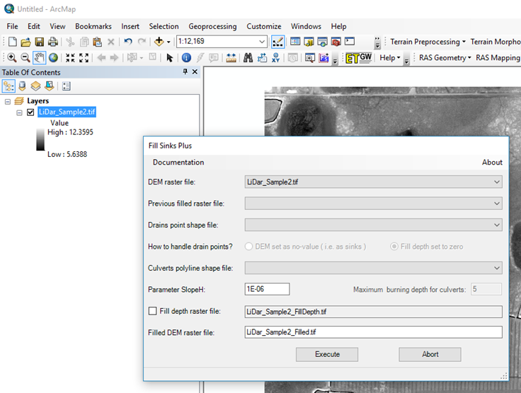
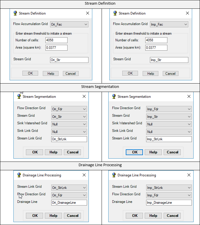
Technical notes The filled map obtained after the fill operation can be seen as a water surface map after adding enough water on top of the topography to fill all the depressions. In the case of the FS operation by ArcHydro, the ponded water surface at depressions is flat. Thus, this approach erases the information of the bottom topography necessary to better establish the stream paths inside the area of the depression. The idea behind FS+ is to add a small slope in the water surface at depressions. The added slope varies with the water depth, such that it recreates to some extent the situation of water flowing through the depressions. In this way, the flow direction operation in ArcHydro, when applied to the filled map can better resolve the stream paths. The user input parameter SlopeH is rigorously the minimum water surface slope allowed between neighboring cells at a water depth of 0.99. This is set to 1e-6 by default, which worked relatively well in the cases tested. Decreasing the value of SlopeH toward 0 causes the FS+ filled map to be closer to the “still water” situation obtained from FS. On the other hand, increasing the SlopeH corresponds to higher flow conditions, which may cause the stream path to deviate from the path at low flow conditions. The units of X, Y, and elevation are assumed equal during the calculation of the slope. In other cases, for example, when elevation is in meters and X and Y are in kilometers, the default value of SlopeH must be changed to 1e-3. There is no known limitations about the maximum size of the raster file that FS+ can handle. The processing of a topography map for South Florida with 21,312 pixels in the horizontal and 34,841 pixels in the vertical directions took 47 minutes to complete in a Desktop PC. FS vs. FS+ In this section, FS+ is compared with the FS operation available in ArcMap/ArcHydro by using the example TIFF file provided. Both Fill operations are applied on that same file, followed by the operations Flow Direction, Flow Accumulation, Stream Definition, and Drainage Line Processing. The ArcHydro steps starting from the original LiDar_Sample2.tif file are detailed below. 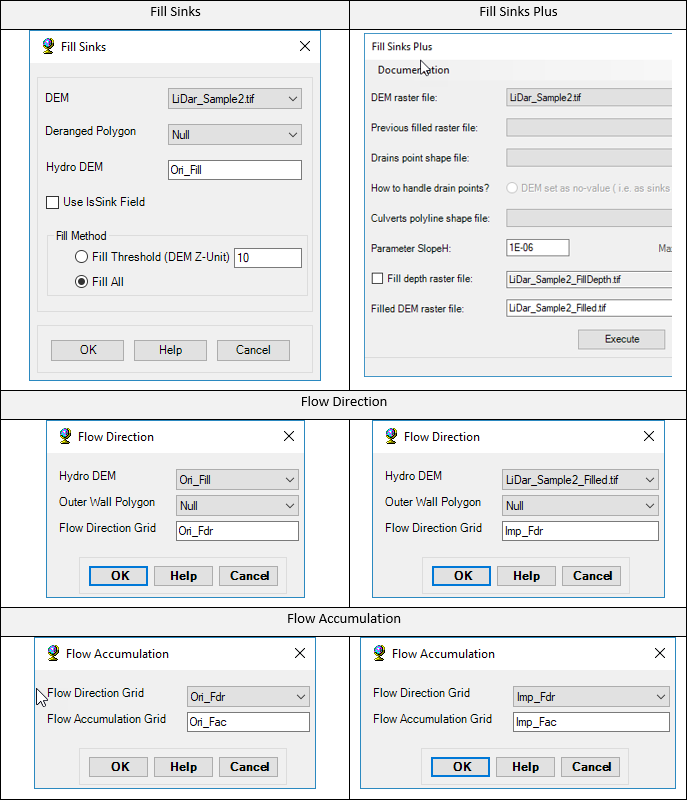
The picture below shows several regions where the blue stream path, computed after FS+, better captures the expected flow path through the deeper areas of the wetland. In those areas, the FS operation of ArcHydro produces mostly straight segments (in red).

In summary, FS+ is recommended for flat topographies since it produces a better representation of the flow path through wetlands and flood plains. In cases of steep topographies, FS+ and FS would generate similar results.
User’s Feedback 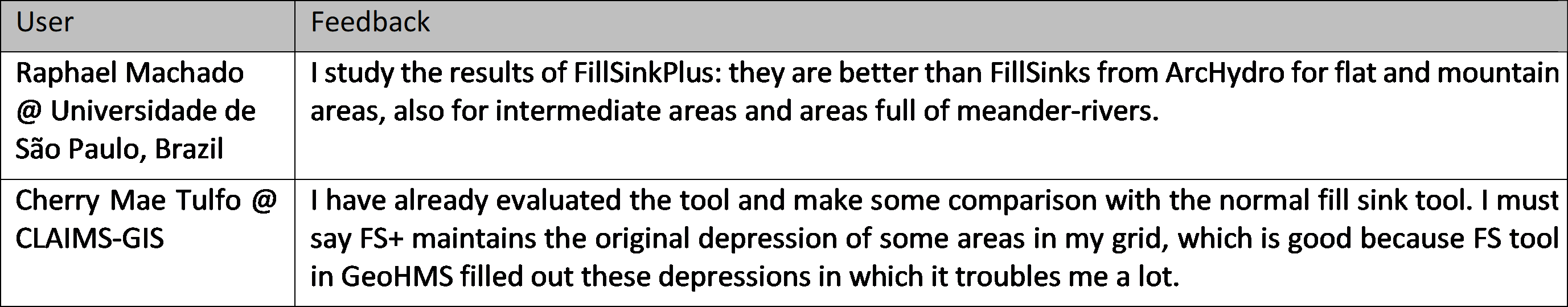
Support
Users can report bugs and send comments by email to [email protected]. Created by Lago Consulting & Services LLC. © 2018. Last updated on 08/14/2019
|

|