
Modeling Services for Surface Water and Groundwater Management
|
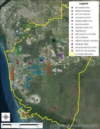
Client: Collier County Year: 2015 - 2016 About: Collier County was in the process of updating its Wellhead Protection Ordinance and needed to update the modeling tools and methods used to define the Wellhead Protection Zones. The County was also concerned about the storm water collection and drainage system potentially contributing pollutants to potable water supply wells pumping from the Surficial Aquifer System. The purpose of the project was to develop an updated groundwater model for the County, define current groundwater capture zones for the specified wellfields, assess contributions from the surface water network and recommend new wellhead protection zones for each wellfield. |
|
Specifics:
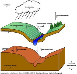
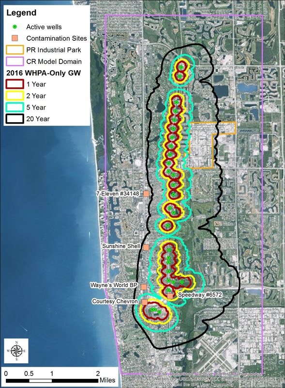
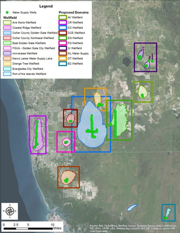
LAGO updated and recalibrated an existing MIKE SHE/ MIKE11 model for Collier County and applied it to complete a surface water and groundwater vulnerability assessment for each of the potable water supply wellfields that utilize draw from the Water Table, Tamiami and Sandstone aquifers, and from surface water source(s). LAGO developed high-resolution, telescoped models for 10 public water supply wellfields and produced preliminary Wellhead Protection Zone maps in GIS format for County review. The preliminary protection zones were developed from the groundwater capture zones and modified to include surface features such as lakes and canals that have a high potential of providing water to the wellfields. LAGO also completed an analysis of flow patterns around known contamination sites in Collier County to assess the possibility of pollutants reaching water supply wells. |
|
|
Applied Skills:
Consulting Areas:
Software Applied:
|
|
|
|
Outcome:
LAGO provided Collier County with preliminary Wellhead Protection Zones for 10 potable water supply wellfields in the County. Each protection zone considers the potential contributions from the surface water drainage network. |


