
Collier County Stormwater Utility
|
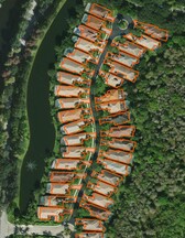
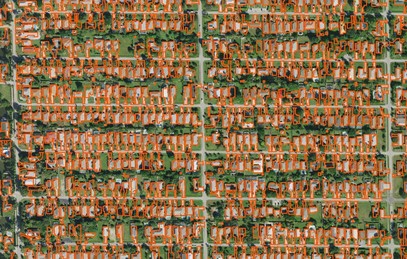
Client: Collier County (sub-consultant to Stantec) Year: 2017 About: Collier County is developing a stormwater utility program. One key element of the process was to complete a financial rate study to establish billing rates and estimate the total anticipated revenues from identified sources. The amount of impervious area per parcel was considered a key parameter to establish the utility rates. This project focused on methods to calculate the impervious area for residential and commercial properties throughout the County using GIS-based processing and analysis tools. |
|
Specifics:
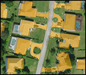
LAGO worked in conjunction with the GIS staff at Stantec to devise the methods used to generate the impervious surface layer for the County. The methodology utilized available data consisting of planimetric lines, parcel boundaries, and building footprints. Aerial images were used to verify results and pervious areas were removed from the database. Properties that are within city boundaries were excluded from the analysis. |
|
|
Applied Skills:
Outcome:
The new impervious layer that includes buildings, parking lots, driveways, and private roads was delivered to the client for review and comment. The Collier County Commission later approved the recommended stormwater utility. |


