South Lee County Watershed Initiative Hydrological Modeling Project
|
Client: Coastal and Heartland National Estuary Partnership (CHNEP) Year: 2020 - 2021 About: The South Lee County Watershed Initiative (SLCWI) stakeholders identified the need for a Strategic Hydrological Modeling and Planning project. The purpose was to identify opportunities to restore more natural hydrology that include restoring wetland water levels and hydroperiods. |
|
Applied Skills:
Consulting Areas:
Software Applied:
|
Specifics:
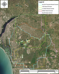
A new MIKE SHE/MIKE 11 model was built around South Lee County areas by using the information from other models for the area. The model inputs included updated rainfall, reference ET, topography, landuse coverage, irrigation coverage and rates, flow paths and surface water structures, hydrogeological parameters, and observation data from surface and groundwater monitoring stations. During model calibration, sensitivity tests to different parameters were conducted. Reported irrigation from large agriculture operations were used to adjust model irrigation parameters. Also, the hydraulic conductivities were adjusted by using a proprietary tool (Adjust dfs2 file) to better match the observation data. The calibrated model was used to build a baseline existing conditions model, which was modified to build a pre-development model (also referred to as NSM) and 5 future conditions scenarios. |
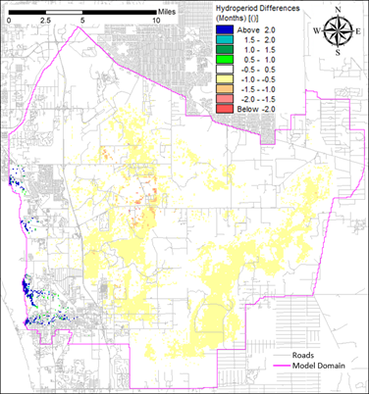
The NSM showed lower water depths and hydroperiods in the areas developed. The effect of future proposed projects on hydroperiods and water depths was also evaluated. Increasing temperatures and ET forecasted by year 2050 produced a drier climate, which results in reduction of hydroperiod by 1 month, of wet season water depths by 0.4’, and of river outflows by 15%. Estimated sea level rise will likely result in changes in vegetation along the coastal boundary. The landward migration of brackish tidal water along the rivers (due to higher tidal levels and reduced river outflows) may have negative impacts on the freshwater resources near the coast. Three landuse change scenarios were also evaluated.


