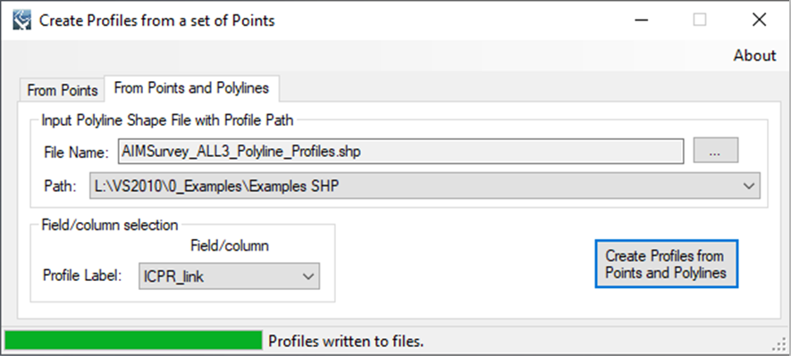
LAGO   Consulting   &   Services LLC
    • Home
    • About Us
      • The Company
      • Leadership
      • Certifications
    • Services
      • Modeling Services
      • Consulting Services
      • Software Development >
        • Fill Sinks Plus
        • HEC-RAS to MIKE11
        • SWMM5 to Shp
        • Lago Toolbox
    • Projects
    • FAQ/Contact
    • LAGO-LG2 JV
  • MENU

Profiles from Points

Purpose 
    This tool computes the station or distance in a profile. The profile points (e.g.; from field measurements) can deviate from the “desired” profile path, and therefore, the station of each point should not be estimated rigorously as the distance from the first point in the profile.

Usage
    A typical workflow with the tool has the following three steps.
  1. The user must specify the point shape file where a field specifies the profile label for each point. From that, the tool will create straight line profiles from the point coordinates by using the best fit method and save them in a new polyline shape file. A new point shape file will be also generated where the computed station value for each point are added as a column. Points with empty profile labels will be ignored.
  2. The user can process in GIS (outside of the tool) the preliminary polyline shape file with the profiles. Typical processing includes flipping the line to change the profile direction, correcting start and end vertices position to make the profile perpendicular to a flow path, and adding more vertices if the profile is not a straight line.
  3. The user can provide the manipulated profile polyline shape file together with the profile point shape file to recompute the stations values. In the case of profile points without an associated polyline, a new best-fit line is added, as in the step 1. Going back to step 2 may be necessary to process profile polylines as necessary.
 
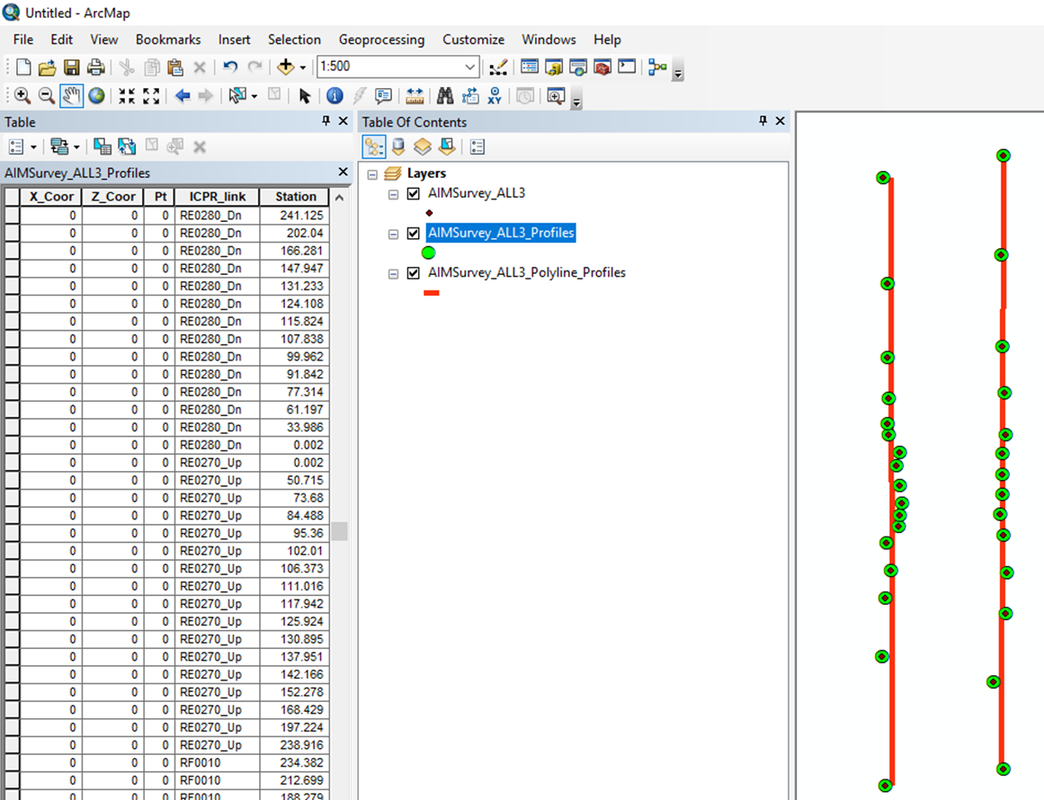
Example of use
    The screens shown below illustrate the processing of a point shape file.​
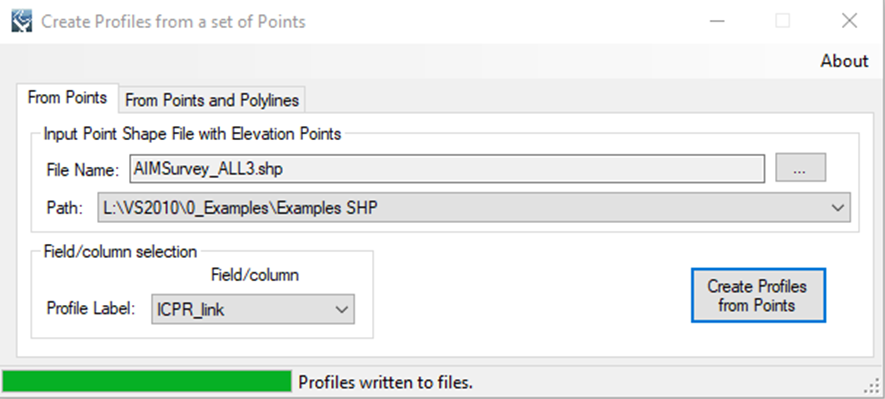
Picture
Picture
Picture
​Registration
    In order to have full functionality of this tool, the user needs to complete the registration by following these steps:
​Go to the right-top corner in this tool, click on the “About” button, and copy the Mac address shown there.
Picture
In the tool’s webpage, use the box above the "Add to Cart" button to enter the Mac address. Then, click on the "Add to Cart" button right below to enter your payment information.
​After these steps, the authorization code will be sent to the email that you provided during the PayPal payment process.

Support
Users can report bugs and send comments by email to [email protected].  
 
Created by Lago Consulting & Services LLC. © 2014. Last updated on 7/14/2019

Questions?
Contact Us

Lago consulting and services understands the customer's risks when downloading  or installing software from internet. The integrity of the software we offer here as well as the legitimacy of our company are ensured by our code signing certificate.
Free version available in the Toolbox or here
for an independent download.
Picture
If you are interested on purchasing this tool contact us for more information. ​
Picture
  • Home
  • About Us
    • The Company
    • Leadership
    • Certifications
  • Services
    • Modeling Services
    • Consulting Services
    • Software Development >
      • Fill Sinks Plus
      • HEC-RAS to MIKE11
      • SWMM5 to Shp
      • Lago Toolbox
  • Projects
  • FAQ/Contact
  • LAGO-LG2 JV
Modeling Services
Picture

- Data mining & Processing
- Conceptualization & Setup
- Sensitivity Tests
- Model Calibration
- Model Telescoping
- Design Storm Simulations
- Scenario Evaluations
​- Post-Processing of results
- Peer review
- Model QA/QC
- Mass balance checks
- Fixing numerical instabilities
- Calibration/validation checks
​- Reservoir Storage Modeling
- GIS data mgmt. and tools

Consulting Areas
Picture

- Natural resources planning
- Stormwater management
- Groundwater management
- Surface water structure design
- Water supply planning
- Species and sediment transport
- Salt water intrusion
- Floodplain delineation & management
- Floodway Encroachment Analysis
​- Urban and coastal flooding
- Water quality studies
- Wetland conservation and restoration
- Wellhead protection area delineation
- Landscape ecology
- Water regulations permitting

Featured Software
Picture

MIKE 11
MIKE SHE
MIKE21
ECOLab
MODFLOW
GWV (Vistas)
MODHMS
​GIS-ArcMap

HEC-RAS
​HEC-HMS
EPA-SWMM
​XP-SWMM
ICPR
​RiverFlow2D
WASP
HSPF

Software Development
Picture

Spreadsheet modeling
File format converters
Pre- & post-processing tools
A la carte software (C#, Python, etc)


Employee Login   ​
         About    |    Terms  and Conditions    |    Privacy Policy    |    Certifications    | ​   Tools    |    Contact us     
Picture
4921 S West Shore Tampa FL 33611, P.O. Box 10481, Tampa, FL 33679.  813-774-5559
www.lago-consulting.com & Lago Consulting & Services LLC.    © 2023  All Rights Reserved