LAGO   Consulting   &   Services LLC
    • Home
    • About Us
      • The Company
      • Leadership
      • Certifications
    • Services
      • Modeling Services
      • Consulting Services
      • Software Development >
        • Fill Sinks Plus
        • HEC-RAS to MIKE11
        • SWMM5 to Shp
        • Lago Toolbox
    • Projects
    • FAQ/Contact
    • LAGO-LG2 JV
  • MENU

 Evaluation of Land Development Scenarios       

Picture
Client: Confidential Client (sub-consultant to Water Science Associates LLC)
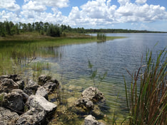
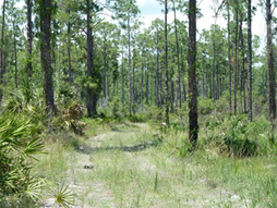
Year: 2014 - 2016
​

About: 
The client asked LAGO to evaluate different land development scenarios and to estimate potential impacts on water budgets, water table level, wetland hydroperiod, and 100-yr flooding levels. The property with an area of about 3500 acres contained mining pits surrounded by wetland areas.​
Picture
Applied Skills:
  • Integrated Modeling: Data mining & pre-processing
  • Model Conceptualization & setup
  • Sensitivity Tests 
  • Scenarios Evaluation
​
Consulting Areas:
  • Surface water management
  • Wetland conservation

Software Applied:
  • MIKE SHE /​ MIKE11
  • LAGO Toolbox
  • ArcMap
Specifics:
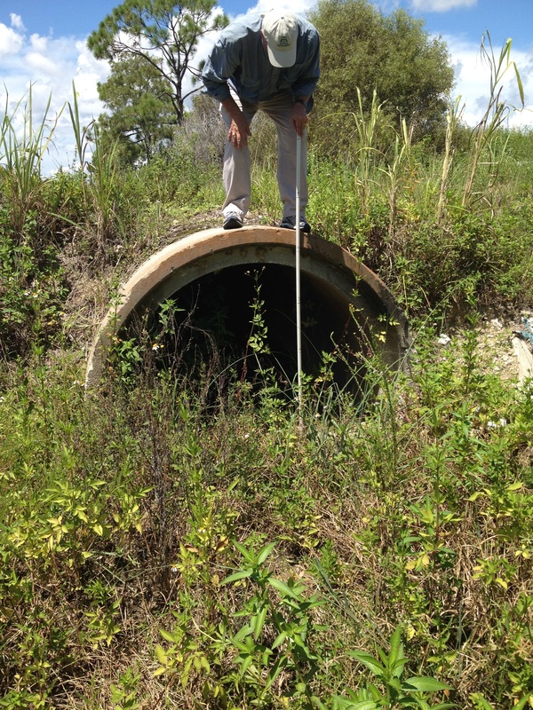
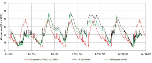
LAGO built a telescoped model containing the property area based on a larger MIKE SHE/MIKE11 model. The higher resolution allowed to add details in the MIKE11 network and to incorporate detailed permit information in order to better represent the existing conditions. The model performance was verified by using observation wells data from different sources.
The model scenarios consisted on including the urban development of the client property, as well as adjacent properties. Model results for the baseline model and different scenarios were obtained considering a 5-year simulation period, as well as design storm simulations.
Picture
Picture
Outcome:
The MIKE SHE modeling study estimated the impact of different development scenarios on water budgets, water table level, wetland hydroperiod, and 100-yr flooding levels. This served as a tool to optimize the design for not showing estimated negative impact to the wetlands and to the flooding levels, which was key during the permitting application process.
<  Previous Project
Next Project  >
  • Home
  • About Us
    • The Company
    • Leadership
    • Certifications
  • Services
    • Modeling Services
    • Consulting Services
    • Software Development >
      • Fill Sinks Plus
      • HEC-RAS to MIKE11
      • SWMM5 to Shp
      • Lago Toolbox
  • Projects
  • FAQ/Contact
  • LAGO-LG2 JV
Modeling Services
Picture

- Data mining & Processing
- Conceptualization & Setup
- Sensitivity Tests
- Model Calibration
- Model Telescoping
- Design Storm Simulations
- Scenario Evaluations
​- Post-Processing of results
- Peer review
- Model QA/QC
- Mass balance checks
- Fixing numerical instabilities
- Calibration/validation checks
​- Reservoir Storage Modeling
- GIS data mgmt. and tools

Consulting Areas
Picture

- Natural resources planning
- Stormwater management
- Groundwater management
- Surface water structure design
- Water supply planning
- Species and sediment transport
- Salt water intrusion
- Floodplain delineation & management
- Floodway Encroachment Analysis
​- Urban and coastal flooding
- Water quality studies
- Wetland conservation and restoration
- Wellhead protection area delineation
- Landscape ecology
- Water regulations permitting

Featured Software
Picture

MIKE 11
MIKE SHE
MIKE21
ECOLab
MODFLOW
GWV (Vistas)
MODHMS
​GIS-ArcMap

HEC-RAS
​HEC-HMS
EPA-SWMM
​XP-SWMM
ICPR
​RiverFlow2D
WASP
HSPF

Software Development
Picture

Spreadsheet modeling
File format converters
Pre- & post-processing tools
A la carte software (C#, Python, etc)


Employee Login   ​
         About    |    Terms  and Conditions    |    Privacy Policy    |    Certifications    | ​   Tools    |    Contact us     
Picture
4237 Henderson Blvd #201, Tampa FL 33629.   |   P.O. Box 10481, Tampa, FL, 33679   |   813-774-5559
www.lago-consulting.com & Lago Consulting & Services LLC.    © 2023  All Rights Reserved